Eastern Bhutan Travel: Tourism Plans for 6 Districts + Route Map
By Best of Bhutan Research Desk · October 20, 2026 · 9 min read
Six dzongkhags in eastern Bhutan are drawing up their own tourism action plans, setting out in writing what each district wants to offer visitors and what it needs to get there. The eastern Bhutan tourism action plans cover Mongar, Lhuentse, Trashigang, Trashiyangtse, Pemagatshel and Samdrup Jongkhar, and were reported between 17 and 19 October 2026 by Kuensel, Business Bhutan and Daily Bhutan.
The short version: each district will list its best attractions, link them into routes, identify what is missing (amenities, trail safety, transport, accommodation) and invite private investors to fill the gaps. The plans are due to be launched this financial year and phased through to 2034.
This post sets out what has been announced, what has not, and what it means if you are planning a trip east. It includes an interactive 3D map of the five road routes into and around the region.
Key Facts at a Glance
| Detail | What has been reported |
|---|---|
| Districts | Mongar, Lhuentse, Trashigang, Trashiyangtse, Pemagatshel, Samdrup Jongkhar |
| What is being prepared | A tourism action plan (TAP) for each dzongkhag, plus a regional strategy for the east |
| Funded by | Department of Tourism and the Voice for Green Change Partnership (EU-funded, 2024–2026) |
| Training led by | Handicrafts Association of Bhutan |
| Training done | Mongar, Lhuentse, Trashigang |
| Training still to run | Samdrup Jongkhar, Trashiyangtse, Pemagatshel — expected to finish by November 2026 |
| Drafting period | September to November 2026 |
| Launch | Within the current financial year |
| Time horizon | Short, medium and long-term phases to 2034 |
| National target cited | At least 300,000 tourists a year (13th Five-Year Plan) |
| Funding committed to projects | Not reported |
What the plans will cover
According to Business Bhutan, each plan has to name the district's "five-star" attractions — its signature sites and experiences — which will then anchor tour packages and the district's identity. The product categories listed are nature, culture, adventure, wellness, spiritual sites, agritourism and food. Daily Bhutan adds that the plans will also look at meetings and conference (MICE) business, and at support for artisans, farmers and small cottage businesses.
Where one site is not enough to justify the drive, the plans are meant to group several into circuits. That matters in the east, where the distances between valleys are long and a single temple rarely fills a day.
Other points in the plans, as reported:
- Private sector first. The approach moves away from government-built tourism towards private investment, including domestic entrepreneurs and foreign direct investment. Dzongkhag and gewog administrations would act as destination managers: coordinating, handling permits and policy, and planning infrastructure.
- Built into local budgets. Tourism goals are to be written into dzongkhag and gewog development plans so that they link to public spending on roads and services.
- Service standards. The Department of Tourism's TASHEL and Tourism Minimum Facility programmes will be used to raise quality.
- One regional brand. Business Bhutan reports the region is to be marketed as the "hidden treasure lands of Bhutan", with each district keeping its own identity inside that brand.
- Mongar goes gewog by gewog. Daily Bhutan reports Mongar's plan will cover all 17 of its gewogs.
What local officials said was missing
The most useful detail for travellers came out of the Mongar training session, reported by Daily Bhutan. Participants listed the problems they see on the ground:
- Destinations get little media coverage.
- Trail safety measures are inconsistent.
- Basic public amenities are in short supply.
- Attractions are sold one by one instead of packaged into itineraries.
- Locally made goods have no certification to prove origin.
- Small producers are hard to find online.
- Transport, accommodation, service training and safety standards all need work.
A gewog administrative officer from Gongdue, Dawa Tshering, said tourism products "need to be packaged more effectively", and suggested pairing eco-lodges with nearby rafting and suspension-bridge sites. Mongar's assistant economic development and marketing officer, Paras Adhikari, described the plan as a "roadmap for community-based tourism" (both quoted by Daily Bhutan).
Why eastern Bhutan tourism matters now
Eastern Bhutan gets far fewer visitors than the Paro–Thimphu–Punakha circuit, a gap Business Bhutan's report acknowledges directly. National policy now asks for that to change. The 13th Five-Year Plan (2024–2029) lists under-visited dzongkhags and year-round arrivals as tourism priorities, and the Bhutan Integrated Tourism Master Plan 2025–2034 sets the framework the new plans plug into. The 2034 end date of the action plans matches the master plan.
Connectivity is the other driver. Both reports link the plans to Gelephu International Airport, which is under construction in the south. Daily Bhutan gives its planned opening as December 2029. A second international gateway closer to the east would make it easier to fit the region into a trip without the long drive from Paro.
Two caveats are worth stating plainly:
- These are plans, not projects. Daily Bhutan notes that proposed investment is not the same as committed funding. No budgets, investors or specific new hotels have been announced.
- The documents are not public yet. None of the six plans has been published. The "five-star" attractions for each district have not been named.
Eastern Bhutan road routes map
Most of the six districts sit on, or just off, two roads: the Lateral Road that crosses the country from Paro to Trashigang, and the highway that runs north from Samdrup Jongkhar on the Assam border. The 3D map below shows those routes and three spurs: north to Trashiyangtse, north to Lhuentse, and the road from Gelephu, where the new international airport is being built. Pick a route to fly along it.
| Route | Main stops | Good to know |
|---|---|---|
| Lateral Road: Paro → Trashigang | Thimphu, Dochula, Trongsa, Bumthang, Thrumshingla, Mongar | The usual way east; several high passes, so plan overnight stops |
| Samdrup Jongkhar → Trashigang | Dewathang, Wamrong, Kanglung | Southern land gateway from Assam; lets you enter or exit without returning to Paro |
| Trashigang → Trashiyangtse | Chazam, Doksum | Short spur to Chorten Kora |
| Mongar → Lhuentse | Kuri Chhu valley | Side road north to Lhuentse |
| Gelephu → Trongsa | Zhemgang | Gelephu International Airport is planned to open in December 2029 |
The route lines are approximate and are not for navigation. Road conditions change with the seasons, so check current conditions and drive times with your tour operator.
What it means for travellers
For a trip in the next 12 months, nothing changes yet. The plans are still being drafted, so there are no new routes, fees or rules to act on. Eastern Bhutan is open now and is already a good trip if you have the time.
Practical points that hold today:
- Getting there. Most visitors drive east from Paro and Thimphu via Bumthang. Samdrup Jongkhar is the southern land gateway from Assam, India, and Yonphula near Trashigang is a domestic airport, as Daily Bhutan notes. Check current flight schedules with your tour operator before relying on a domestic flight.
- Time. Allow at least 10 days for a trip that reaches Trashigang. Our opinion piece Eastern Bhutan: The Case for Going East and Staying Longer sets out sample itineraries.
- Costs. The Sustainable Development Fee applies per night wherever you stay in Bhutan. See our SDF guide for current rates and discounts.
- Expect basic facilities. The gaps local officials listed — amenities, trail safety, accommodation — are what you will notice on the road. Choose an operator with experience in the east and confirm lodging in advance.
- Things already worth the trip. Mongar has the new Latongla–Zhongar birding trail on the Trans Bhutan Trail. Lhuentse has the Jigme Namgyal Museum in a restored historic manor, which Daily Bhutan cites as the kind of heritage site that can anchor eastern itineraries. Trashiyangtse has Chorten Kora.
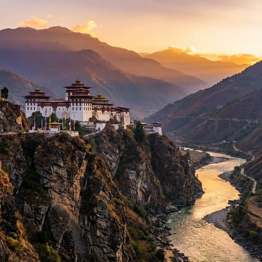
Trashigang Dzong. Trashigang is one of the three districts that have completed their action plan training.
Over the longer term, if the plans are funded and carried out, the likely changes are more packaged multi-site circuits, more community-run and eco-lodge options, better trail safety and signage, and certified local crafts. We will update this post when the plans are launched and the attractions are named.
Related planning links
- Eastern Bhutan: The Case for Going East and Staying Longer
- Trans Bhutan Trail in Monggar: The Latongla–Zhongar Birding Trail
- Gelephu International Airport: Airfield Contract Awarded
- Understanding the SDF
- Bhutan Tourism Statistics
- All places in Bhutan
Frequently Asked Questions
Which districts are in eastern Bhutan's tourism action plans?
Six dzongkhags: Mongar, Lhuentse, Trashigang, Trashiyangtse, Pemagatshel and Samdrup Jongkhar. Each is preparing its own plan, alongside a regional strategy for the east.
When will the eastern Bhutan tourism plans take effect?
Drafting runs from September to November 2026, and the plans are expected to be launched within the current financial year. Projects are phased over the short, medium and long term up to 2034.
Is eastern Bhutan open to tourists now?
Yes. You can visit all six districts today with a licensed tour operator and guide. The action plans do not change entry rules, fees or permits.
How do you get to eastern Bhutan?
Most travellers drive east from Paro and Thimphu through Bumthang. Samdrup Jongkhar is a land border town with Assam, India, and Yonphula near Trashigang is a domestic airport. Gelephu International Airport in the south is planned to open in December 2029.
What is the best road route to eastern Bhutan?
Most visitors take the Lateral Road east from Paro and Thimphu through Trongsa, Bumthang and Mongar to Trashigang. The alternative is to enter or leave by land at Samdrup Jongkhar on the Assam border, which lets you cross the country one way instead of driving back to Paro. Both routes are on the map above.
How many days do you need for eastern Bhutan?
Plan on at least 10 days if you want to reach Trashigang from Paro by road, and 12 or more to cross the country and exit through Samdrup Jongkhar.
Sources: Kuensel (17 October 2026), Business Bhutan (19 October 2026), Daily Bhutan (19 October 2026), Daily Bhutan on the Jigme Namgyal Museum (28 September 2026).